An ancient canal and very flat lands – Fossdyke & Witham navigations
Apologies, this is a long one as I wanted to cover the whole length of this navigation in one post and it has taken me a while to navigate it (it’s 43 miles!) and write it up.
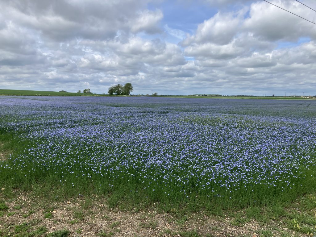
The Fossdyke & Witham navigations in Lincolnshire come in two very distinct parts. The Fossdyke is an 11 miles long canal running between the Trent and Lincoln and the Witham is 32 miles of river from Lincoln to Boston. They connect in Brayford pool in Lincoln.
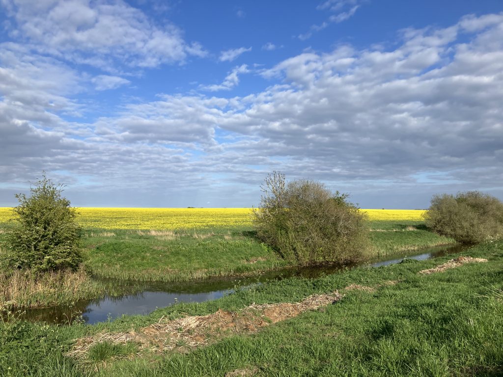
The whole area is shaped by the water management of the low lying fens. As I am always interested in this, I created an extra page around the water management for those people who want to learn more about this.
History of the Fossdyke canal
As ever I would like to tell you a bit about the history. This time it is very different, as the Fossdyke is a canal that was built by the Romans around 120 AD! The Romans founded Lincoln (Lindum Colonia) by the river Witham, which flows towards the Wash. They built the Fossdyke canal to connect the Witham to the Trent, which opened up an inland waterway from the North Sea to another Roman stronghold – York. Allegedly, the Vikings used the Fossdyke as well during their invasion of the North East.
In 1121 the canal was widened and deepened and subsequently became an important commercial waterway including transporting stones for the building of Lincon cathedral.
In 1672 Torksey lock was built at the junction with the Trent. Before this the Fossdyke must have been tidal most of the way up to Lincoln as the land is so flat that there are no locks all the way to Lincoln. In the 1700s and 1800s the Fossdyke had a boom period with coal being transported in from Nottingham and farm produce and wool sent out to the textile mills in Leeds and other cities.
Travelling the Fossdyke
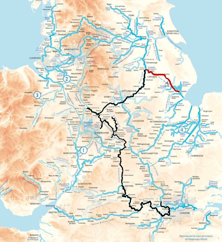
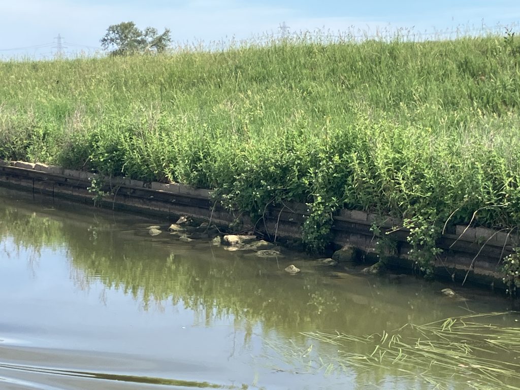
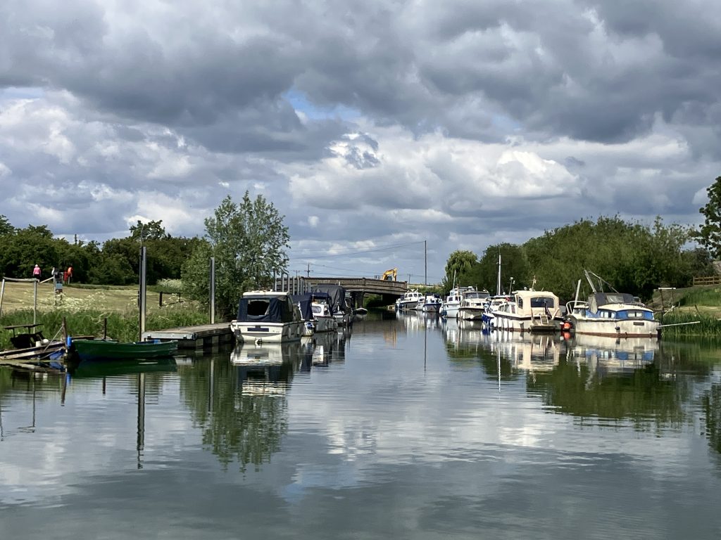
Flanked by high banks on both sides it is not possible to see much of the surrounding landscape (a preview of things to come on the Witham). It feels a bit like travelling on the canals in Holland.
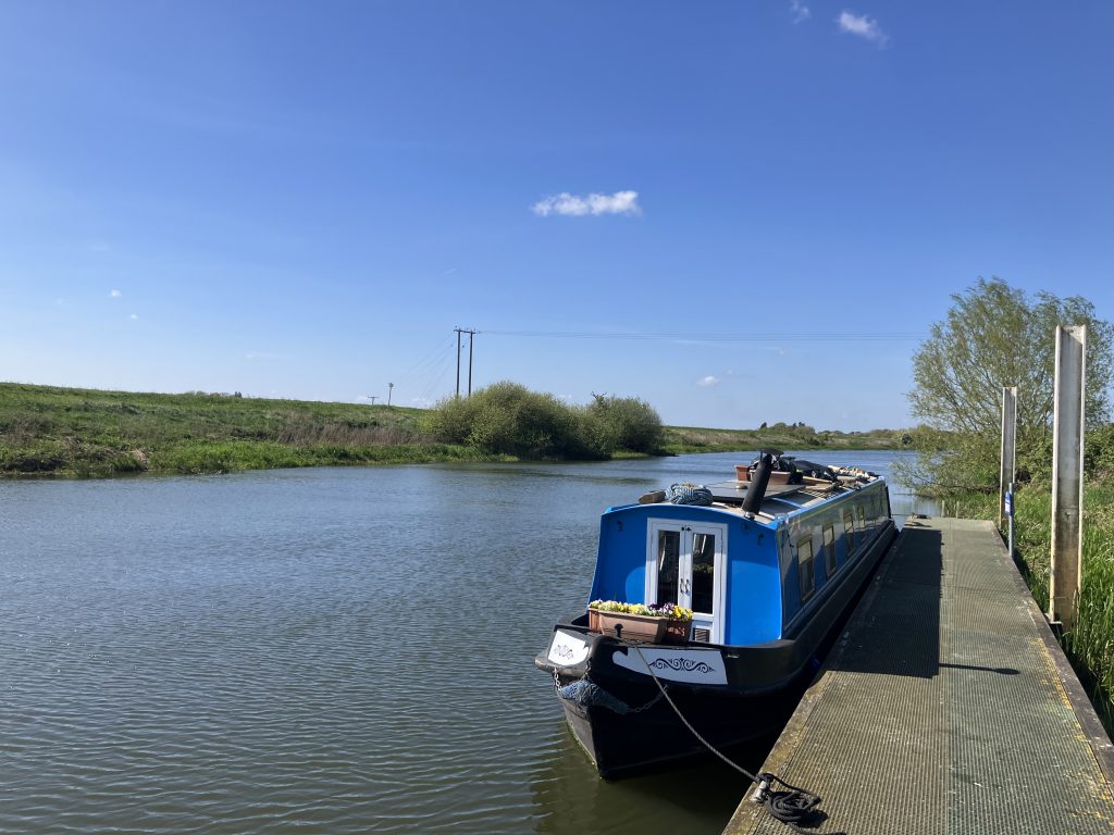
The first significant settlement on the Fossdyke coming from Torksey is Saxilby. The name sounds medieval and interesting, but the village does not really live up to that. It does have lovely visitor moorings though. It used to be the site of the only bridge over the Fossdyke, a swing bridge that allowed sailing barges to sail through with their mast up all the way.
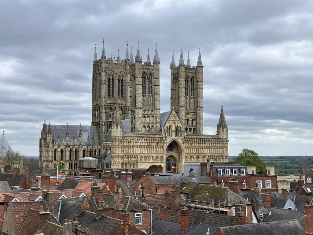
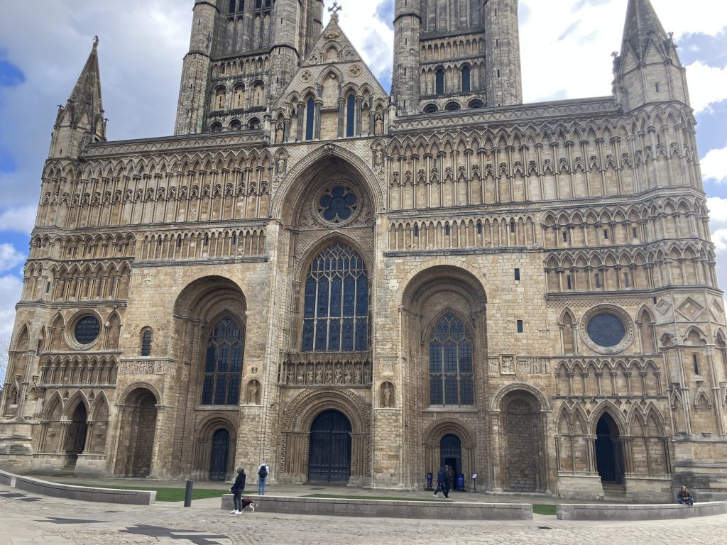
Next up is the first glimpse of Lincoln cathedral high up on the hill, commanding the landscape. What a magnificent location!
The Fossdyke has random piles of rocks in the water by the bank over a long stretch. They are supposed to be a clever way of helping deer to get out of the water (“deer ramps”). I am not sure how successful they are, as I sadly saw seven dead muntjac deer in the water. But who knows how many more were saved?
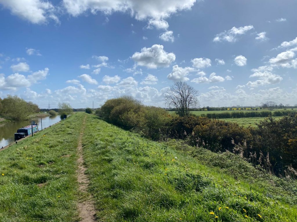
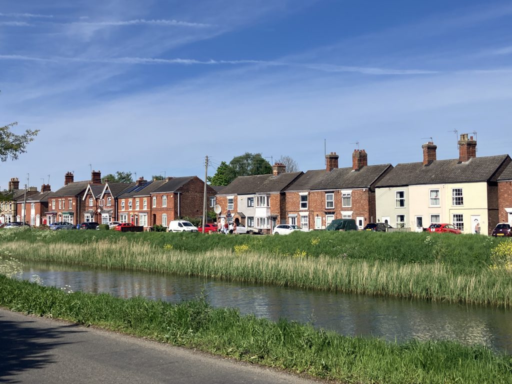
Lincoln
The arrival into Lincoln from the Fossdyke is a bit of a mixed bag. The official visitor moorings had squatting cruisers on them in a long line. They were not only full, but also looked quite unappealing. Directly after those moorings is Brayford pool, the old industrial port of Lincoln. It is today all surrounded by modern buildings with shopping, bars and restaurants on one side and the University of Lincoln on the other side. It somehow didn’t appeal to me at all.
Brayford pool also contains a large marina where visitors can moor for a hefty fee, which I was not willing to pay.
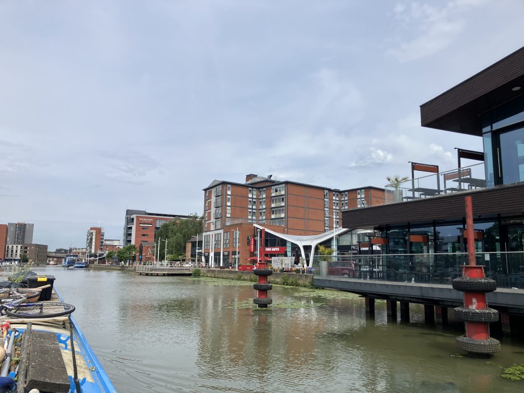
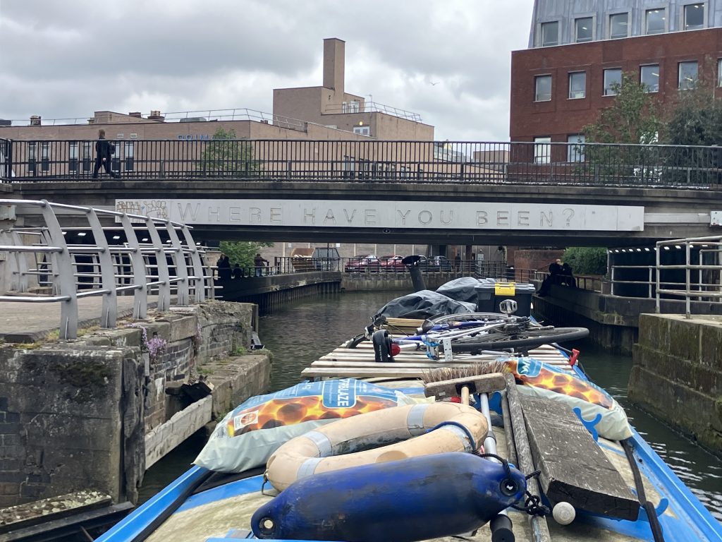
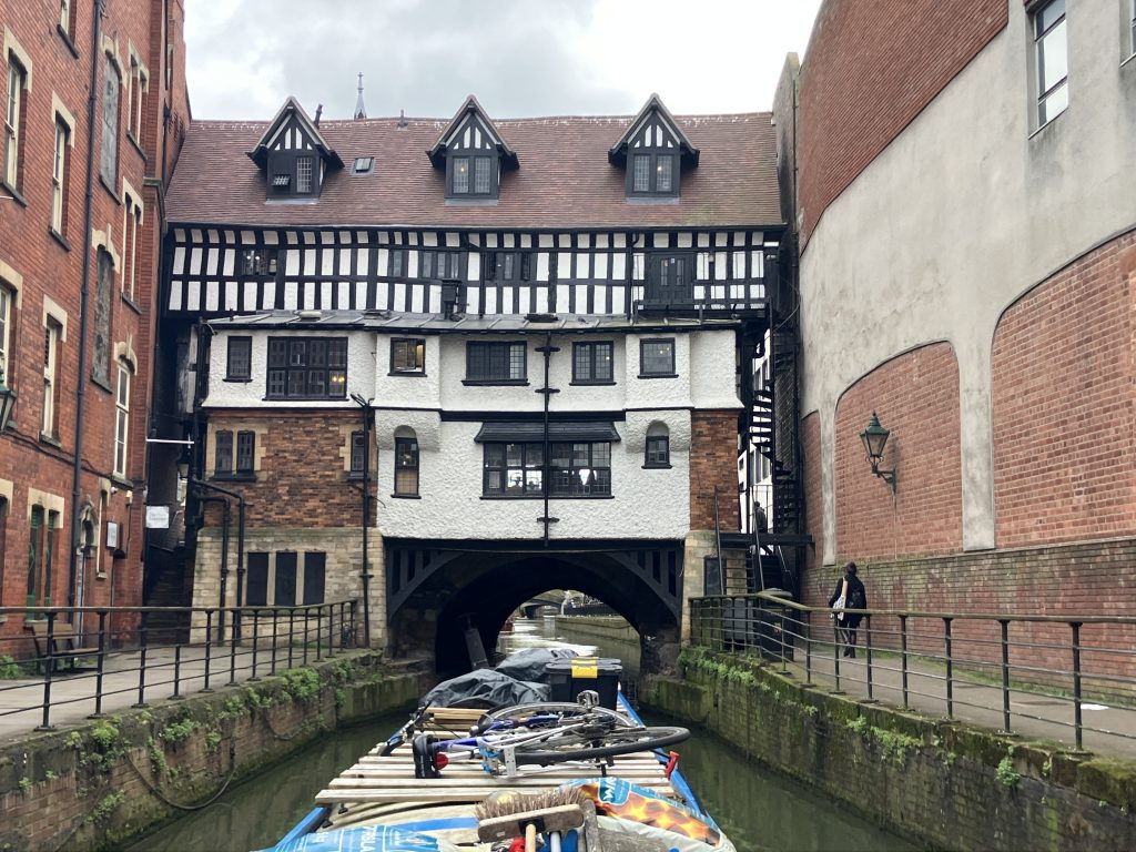
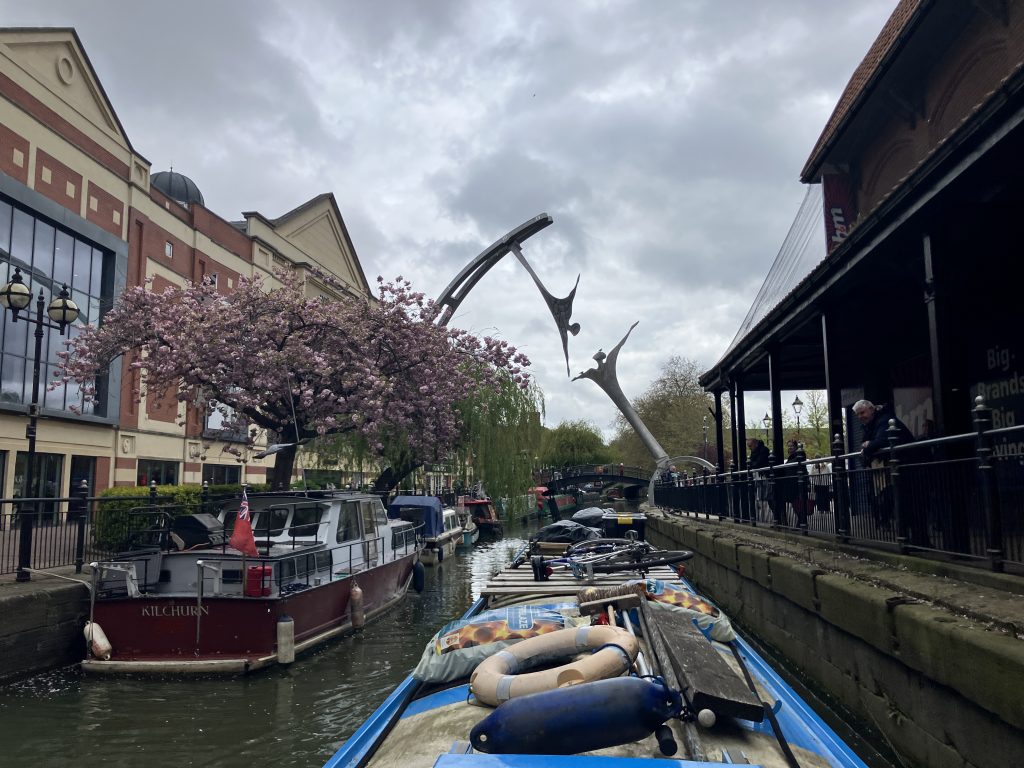
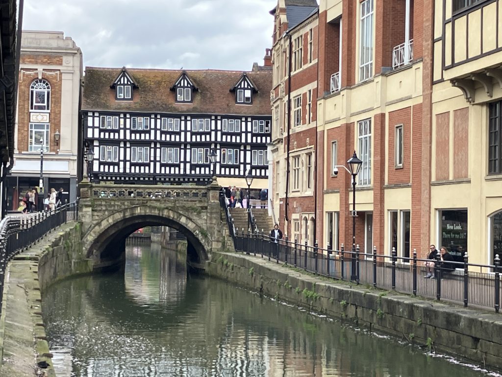
Crossing the pool I started to feel a bit disappointed that I won’t be able to moor in Lincoln at all. At the far end of Brayford pool the navigation transitions onto the river Witham. And lo and behold, this is where the real city centre actually starts, going through the High Bridge (aka the Glory Hole – yes really!)
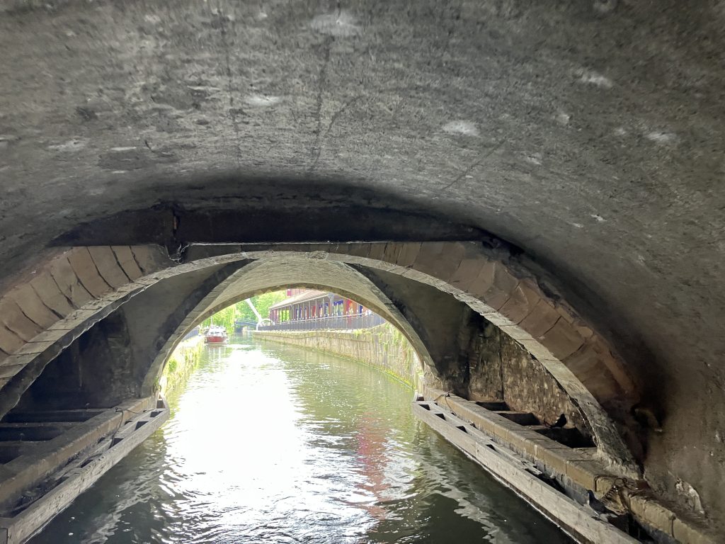
After the Glory Hole the river goes under a big metal sculpture spanning the waterway. All along the subsequent stretch the bank has mooring rings and there was lots of space.
The river is fenced off all along, which is great to deter punters from climbing on the boats. Fortunately there are gates to get out as well!
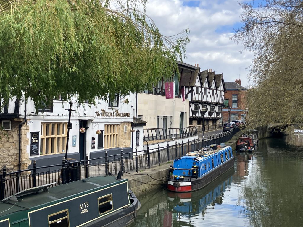
I moored in the most gorgeous spot in front of a 13th century building, which is now a pub. Mooring in front of a pub is not ideal if you want to get any sleep, but fortunately this one was a fairly calm watering hole.
It is always slightly weird though to have people sitting outside right in front of my windows. At one point I had two little boys on their knees staring and pointing into the window. I sometimes think people believe we are an attraction laid on especially for them!
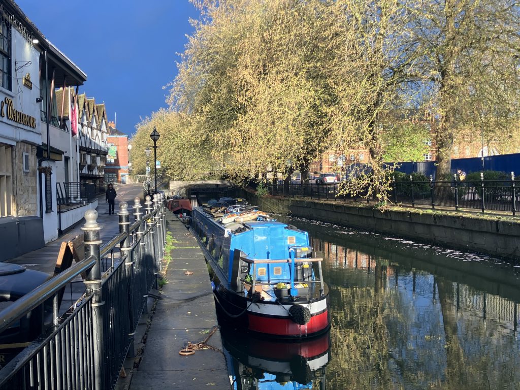
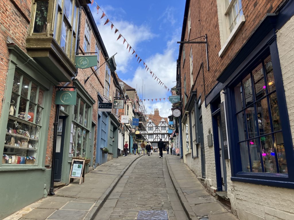
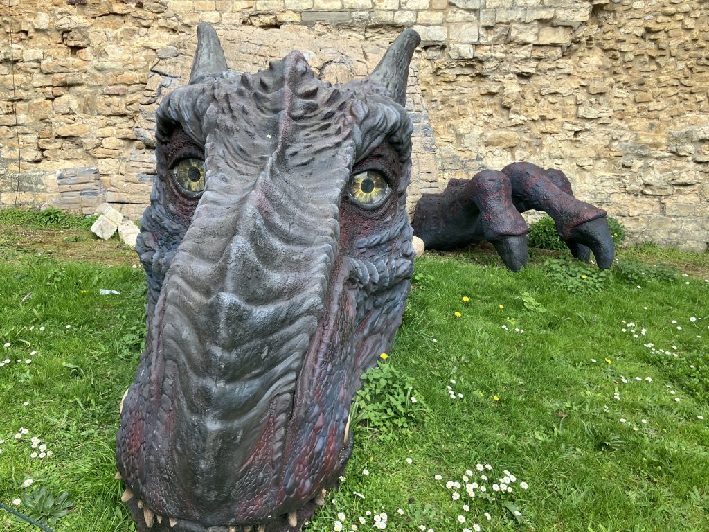
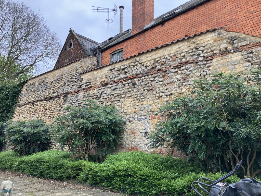
And here are some more pictures of Lincoln, which is so beautiful:
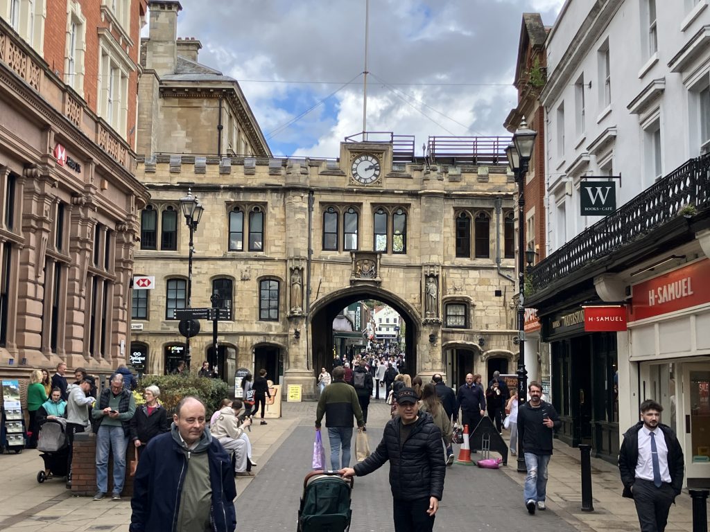
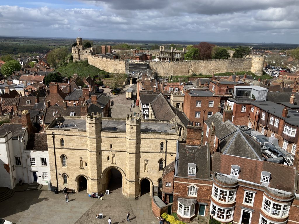
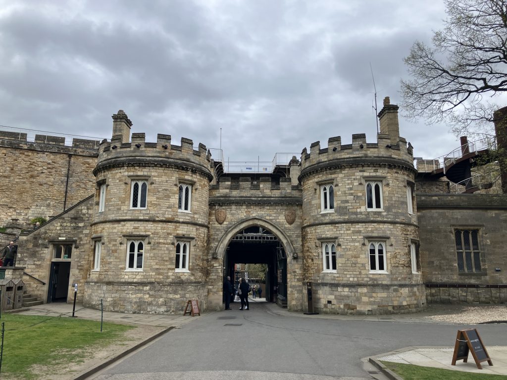
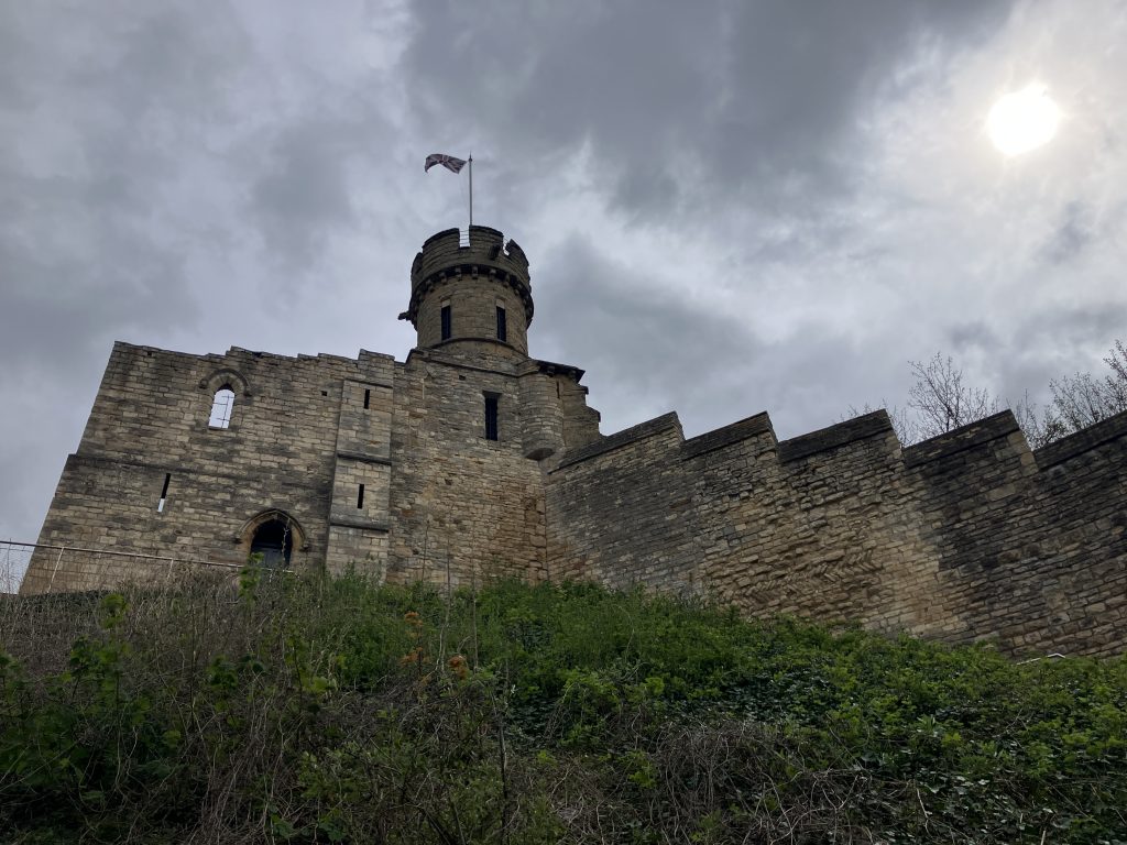
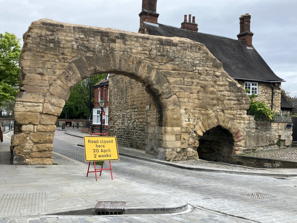
There are also a number of Roman remains dotted around the hill that the cathedral and the castle sit on.
The arch is the oldest gateway in Britain through which traffic still passes.
Travelling on the river Witham
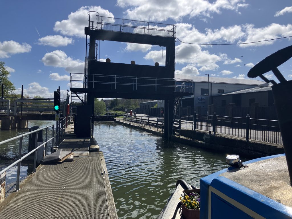
After a few days of sightseeing and chores it was time to leave Lincoln for the long trip to Boston. Transitioning onto the Witham feels different straight away. The river is much wider and very straight. Navigation on the Witham is made possible by the Grand Sluice in Boston. I’ll come back to that further down.
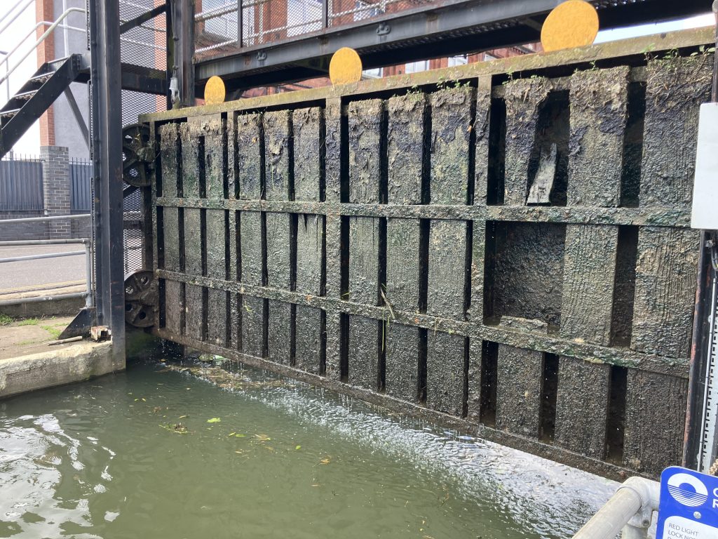
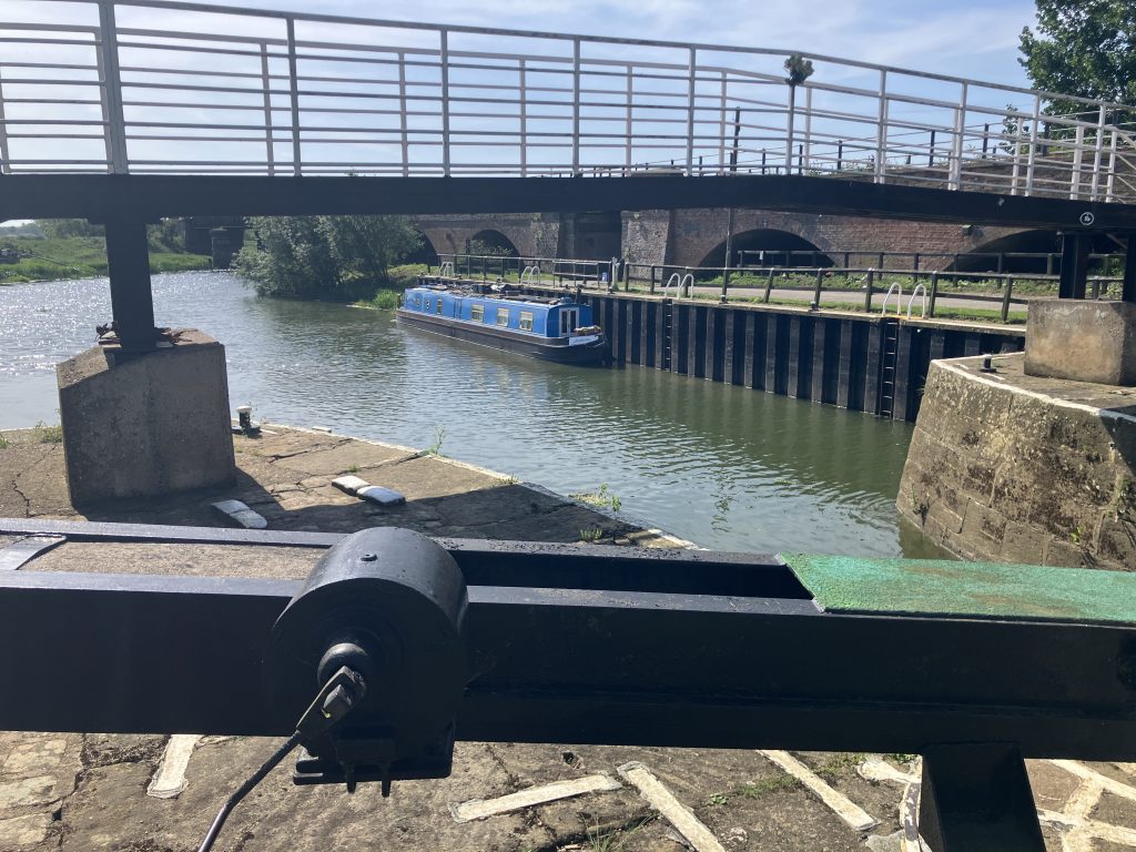
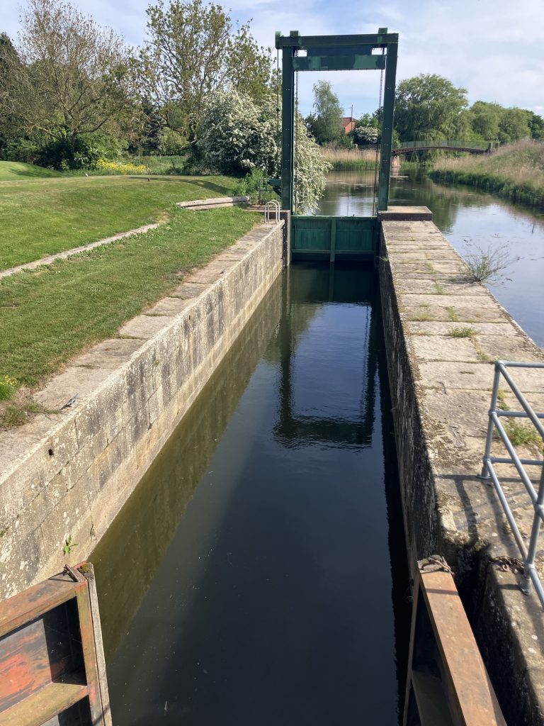
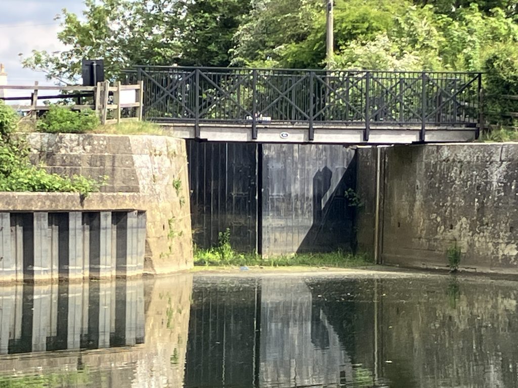
Not far from the city centre is Stamp End lock and a substantial weir. This was no ordinary lock, but my first experience of a guillotine lock, where the top gate is pulled up for boats to go in.
When the gate is down/closed, its top edge is almost level with the water with only some small markers sticking up. When I arrived, there was a boat in the lock and the gate was down. From a distance I couldn’t see the gate in the water at all and I thought I could go straight into the lock next to the other boat. There was an amber traffic light, but I had no idea what that was trying to tell me. As I got closer I realised that the lock was actually closed and that the boat was already going down. I firmly believe that light should have been red!
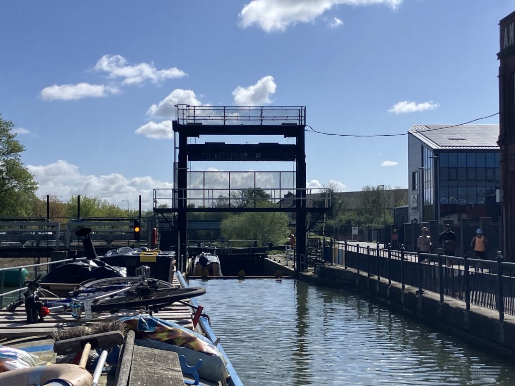
It was an interesting experience to operate this (electric) lock, especially the part where you have to go into the lock under the raised gate. It didn’t live up to its name fortunately, but it was sure dripping heavily. I still don’t really understand the lights.
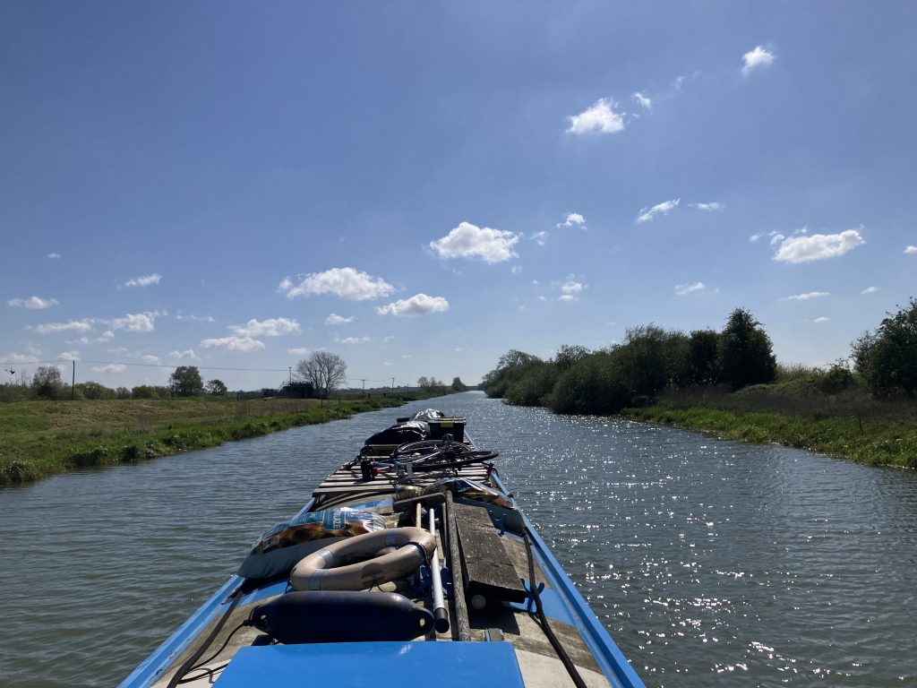
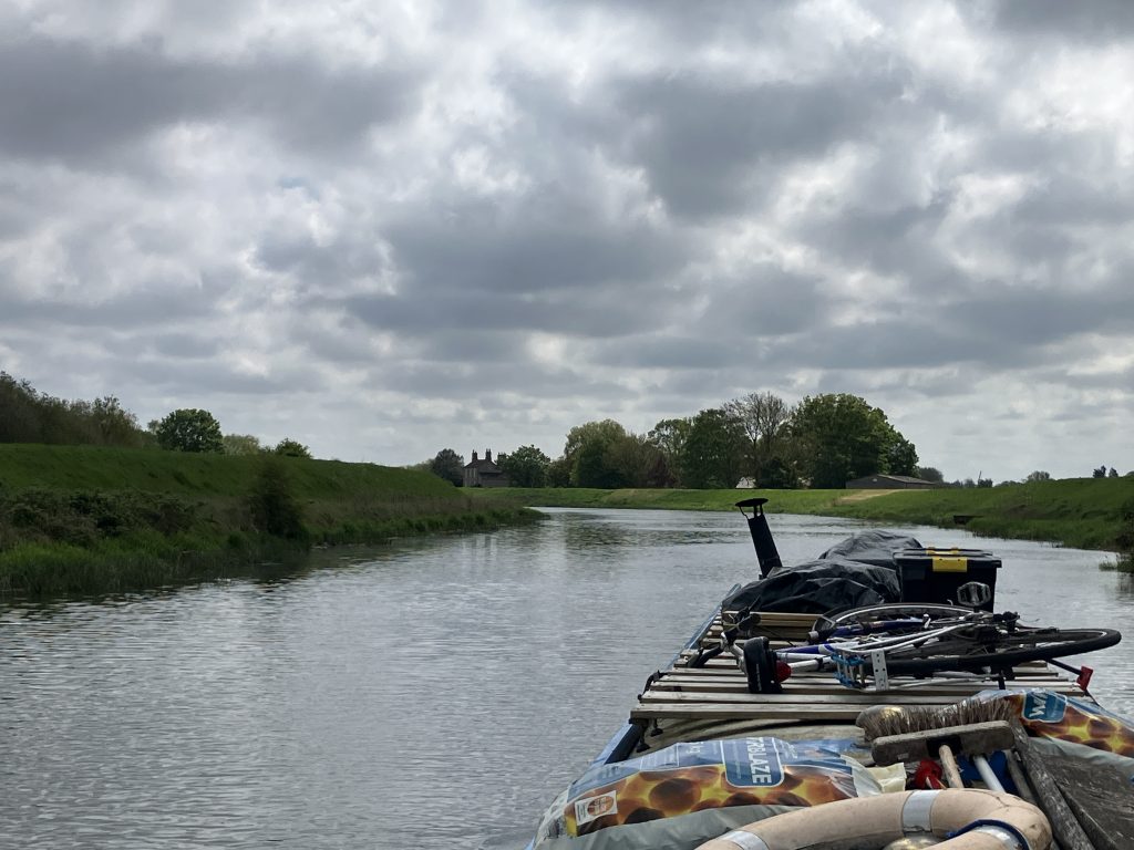
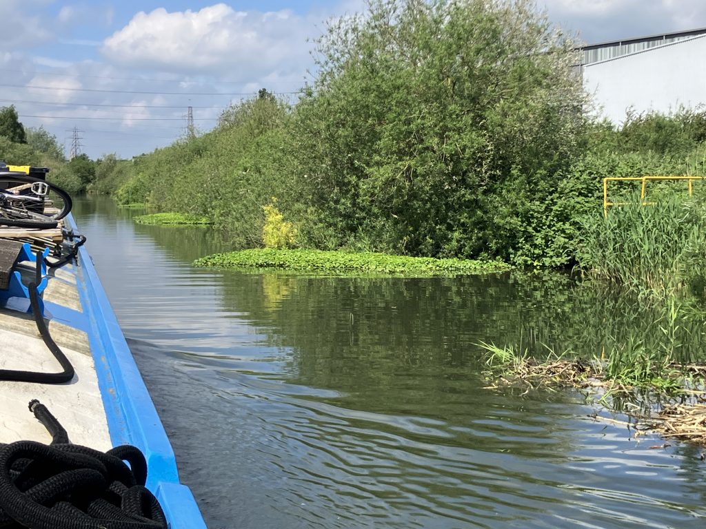
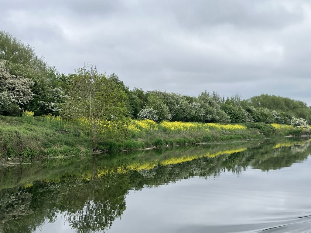
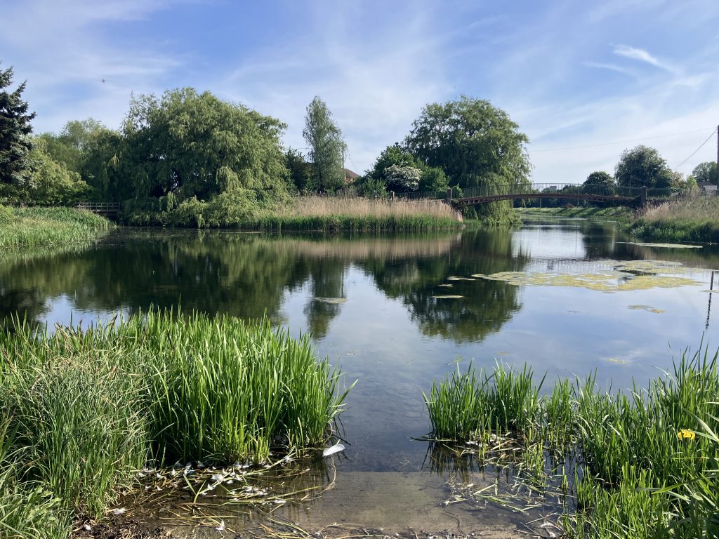
After this lock the river becomes completely rural very quickly. I had heard some people say that the Witham is a bit boring as it’s very long, very straight and enclosed by high banks so you cannot see the land beyond when you are travelling by boat.
This is all true, but it is also gorgeous. As you cannot see the land, the main attraction when travelling were the birds for me. I am not a bird expert, but besides the usual crowd I saw lots of herons, egrets, oyster catchers, arctic terns and my clever birdsong ID app identified five different types of warblers plus many more songbirds.
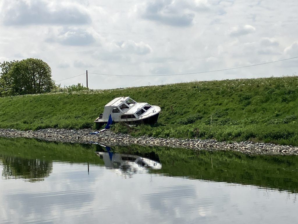
The river banks are mostly stony slopes, often covered in reeds and absolutely unsuitable for mooring. There are probably only around 10 designated places to moor on floating pontoons.
Floating pontoons are so nice though, especially after the Trent. No climbing on walls, no fluctuations of water level, just step off at a nice level and throw the ropes round the cleats.
On the way down I rarely had other boats on the pontoon with me. There was almost nobody there, which reinforces the emptiness of the landscape around. After the “standard” Midlands canals and the big river Trent, this was a very different experience.
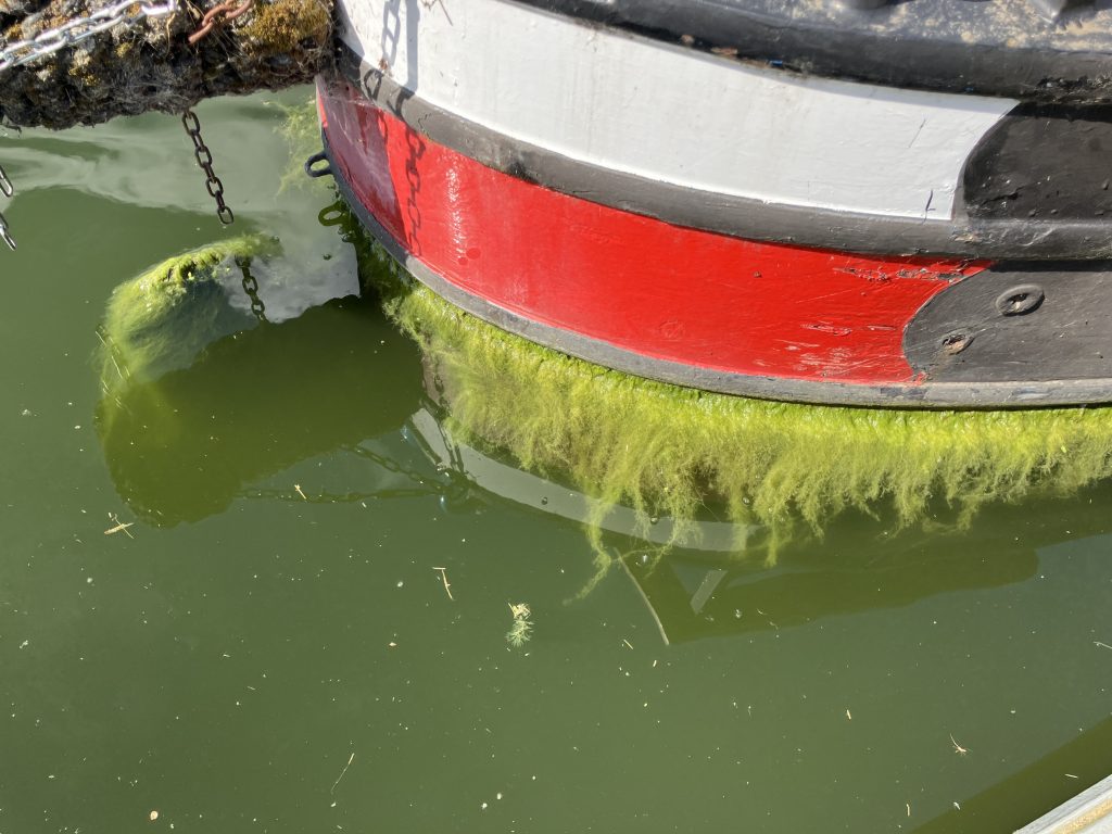
I heard that in the summer the river is plagued by weeds and on the way back I could see some weeds growing already. As there were no boats and the river is wide and straight, I was able to travel at a swift speed. In the summer ploughing through the weeds, this wouldn’t have been much fun.
An indication of the weed in the river is the impressive “boat beard” that Willum has grown here.
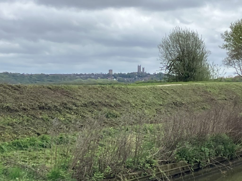
The stops on the Witham are mostly a bit same-y. Moor up on a pontoon, climb up on the high bank, have a look around, see Lincoln cathedral in the distance for an astonishing long way and otherwise endless flat fields and drains.

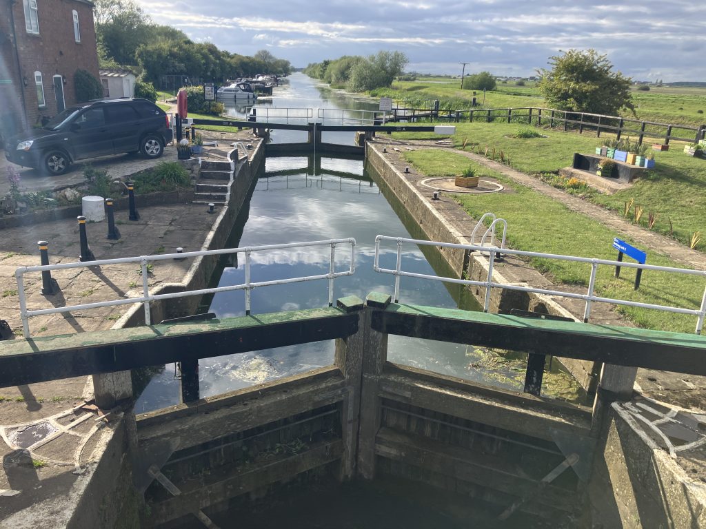
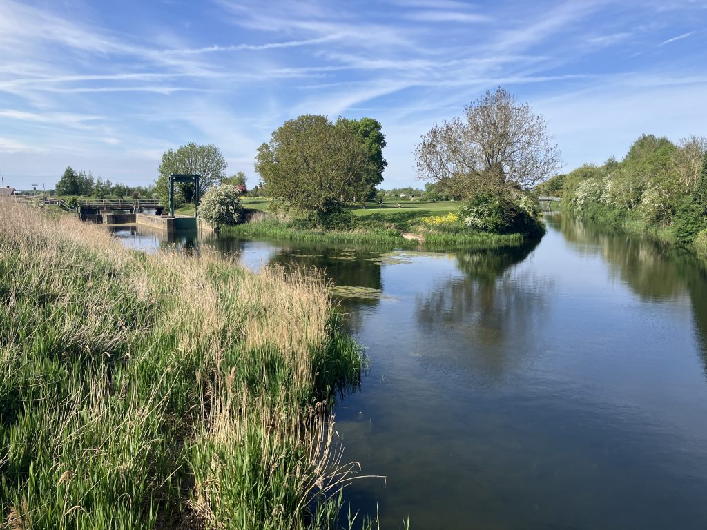
The land is so flat that over the 30+ miles between Lincoln and Boston, there is only one lock at Bardney. After so much straight river, a lock is a welcome change.
My journey was hampered by a stomach bug and subsequent slow recovery, which impacted me for two weeks. I limped forward slowly to at least get to some shops for supplies.
Woodhall Spa
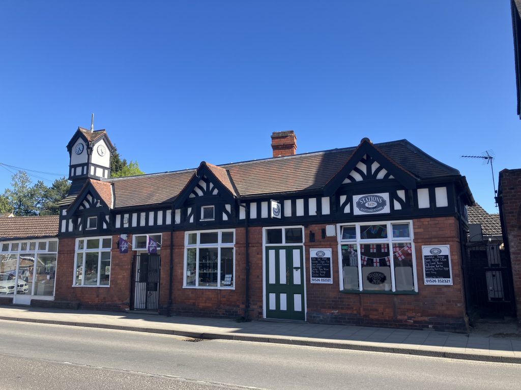
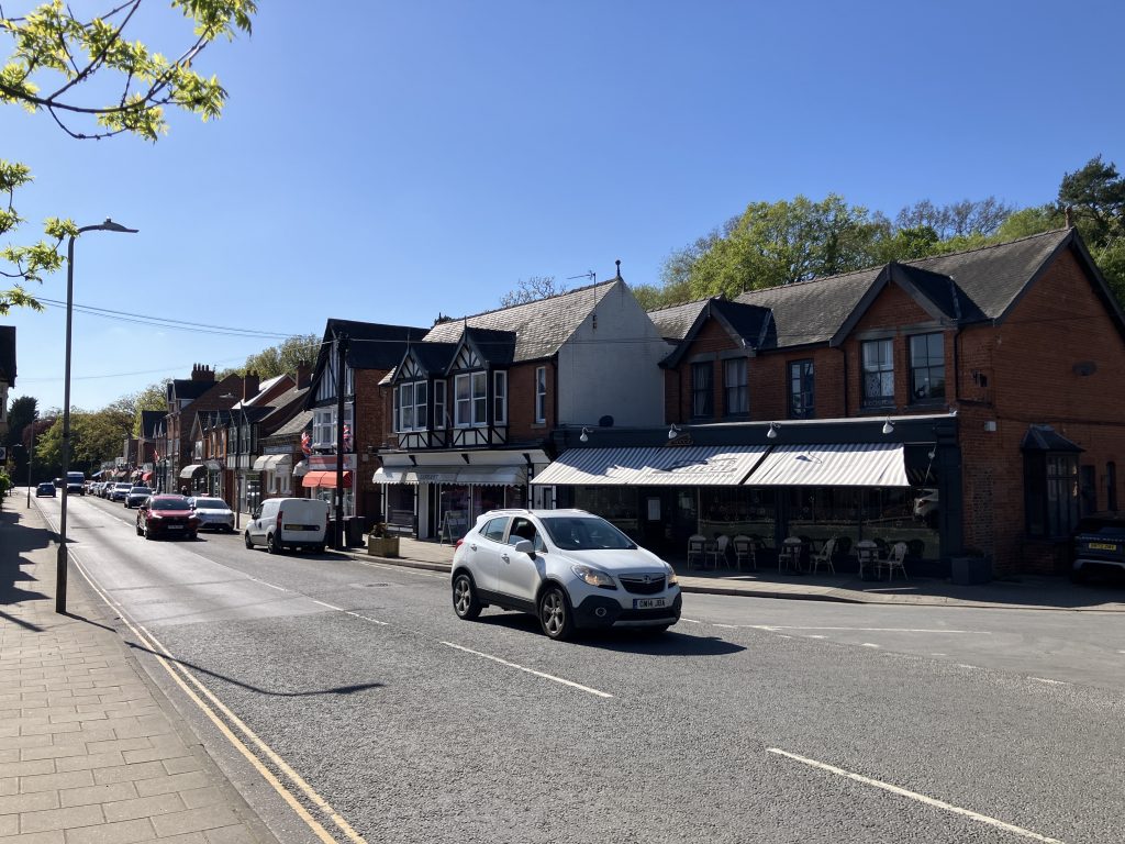
I finally arrived in a place with some much needed shops: Woodhall Spa, a Victorian town purpose built after discovery of a mineral spring. About a mile from the river it is a pretty but also slightly weird place. It looks so cookie cutter Victorian/Edwardian that it’s almost like a theme park or a museum village. To me it also looked a bit like a posh version of Bourneville, the custom-built town for Cadbury workers with its uniform rows of shop fronts.
Here are some pics of the high street:

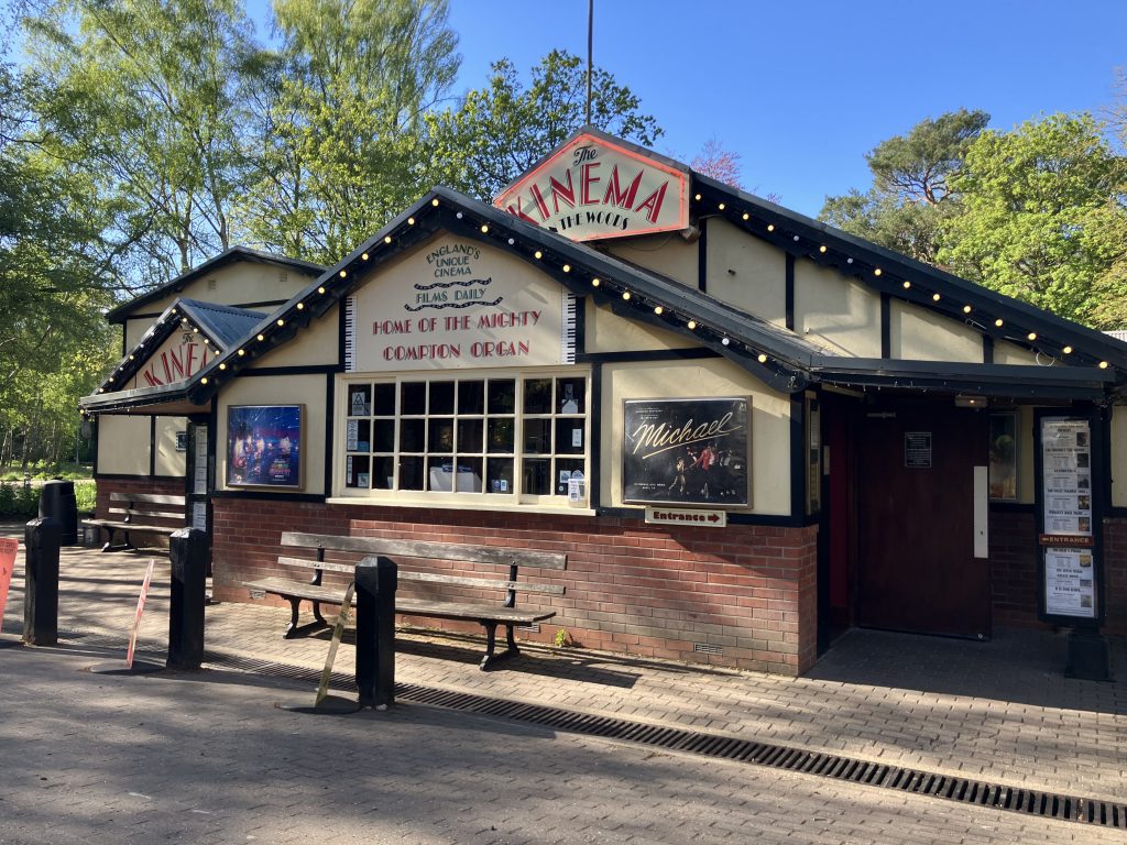
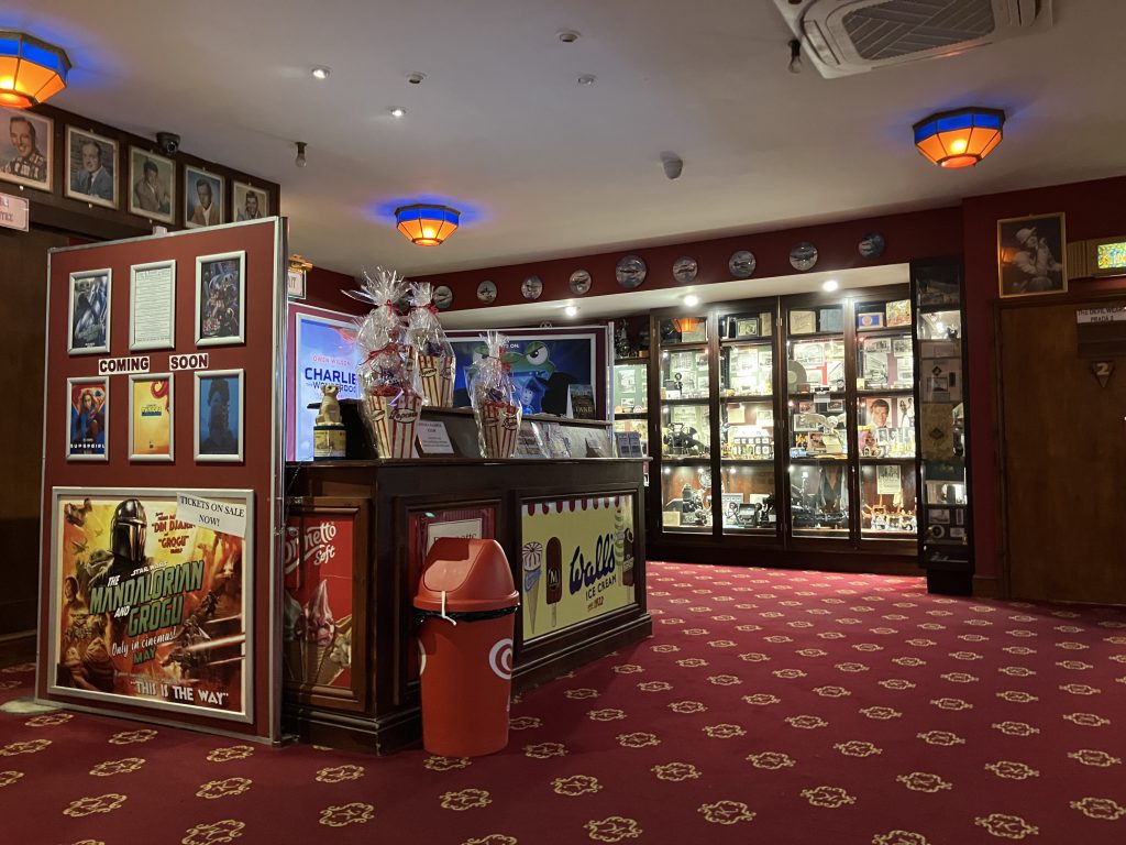
One the of attractions in Woodhall Spa is the Kinema in the Woods (no idea why it’s spelled with a K). It is a treasure trove of movie memorabilia and nostalgia and best of all has an original Compton cinema organ. The whole place is a real experience! On the way back I was lucky to be there on a day when the organ was played during an intermission. When have you last had an intermission in a film?
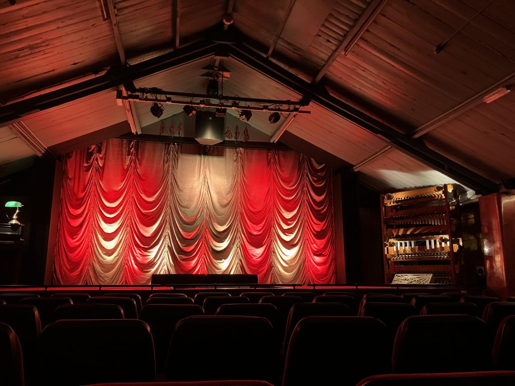
He played not only the organ, but also the piano on the left and the “plastic-tube marimba” on the right, all from his organ manuals.
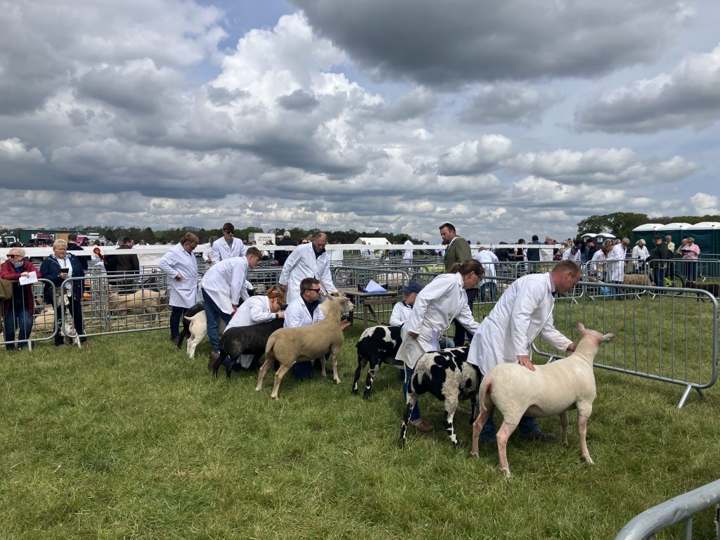
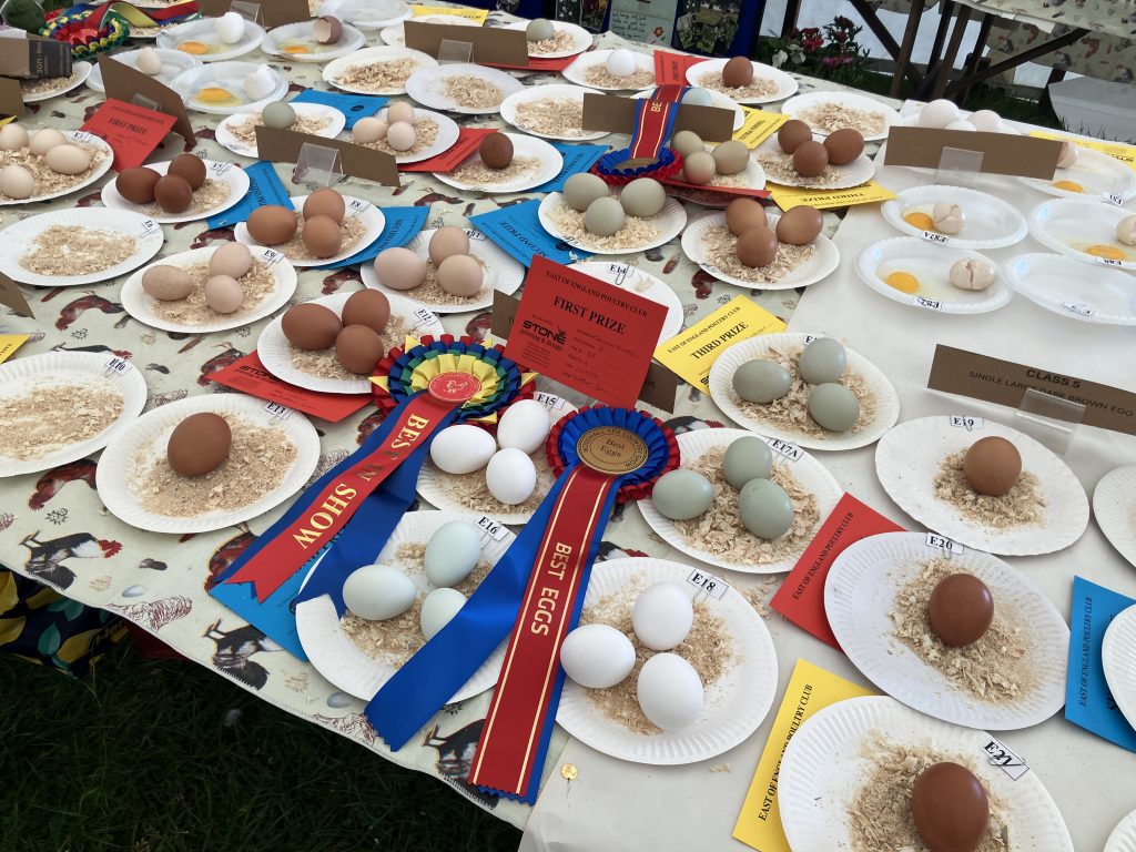
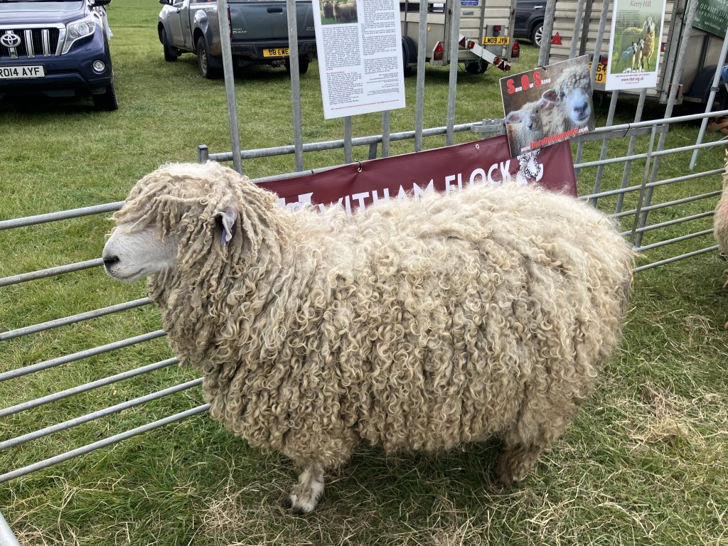
Also on the way back I had a chance to go to the annual country show. It was my first time at an event like this. I loved it! It was interesting mix of posh town people and farmers, lots of tweed and sheep dogs. There were sheep, cattle and poultry competitions (including eggs!), a tractor parade, a falconry display and lots of other bits and bobs that are interesting to the farming folk of Lincolnshire.

Dogdyke
From Woodhall Spa I cruised for only about 1.5h to Dogdyke on a more interesting stretch that winds around and is more wooded. My attempt to visit a historic pumping station under steam was not to be as the many drains didn’t allow me to get there even though I could see it only a few hundred metres away.
Dogdyke is also very close to RAF Coningsby and the runway direction is right over the river. I saw no spectacular take-offs, but I did see a big cargo plane circling overhead several times doing sharp curves. A pilot in training perhaps? On the way back I saw a fighter jet doing loopings and rolls over the river for a while.
The last miles to Boston
After the more interesting section the river becomes very straight and – yes – a bit boring again. I was now mostly focused on doing the miles to get to the end of the line in Boston. In the more cloudy weather the landscape had an almost eerie bleakness to it and according to Google maps there are no villages around at all on that stretch.
On the way I passed the entrance to Kyme Eau, a strangely French sounding waterway also known as the Sleaford navigation. It is a little river which is allegedly hard going and has very low bridges, so I skipped this one.
Boston
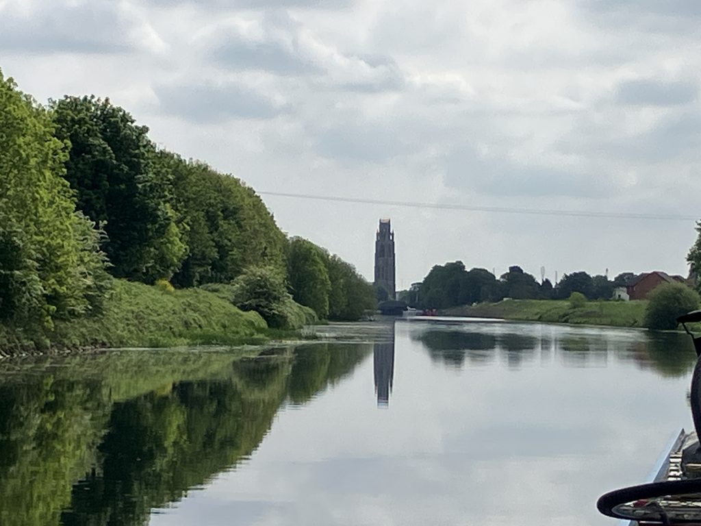
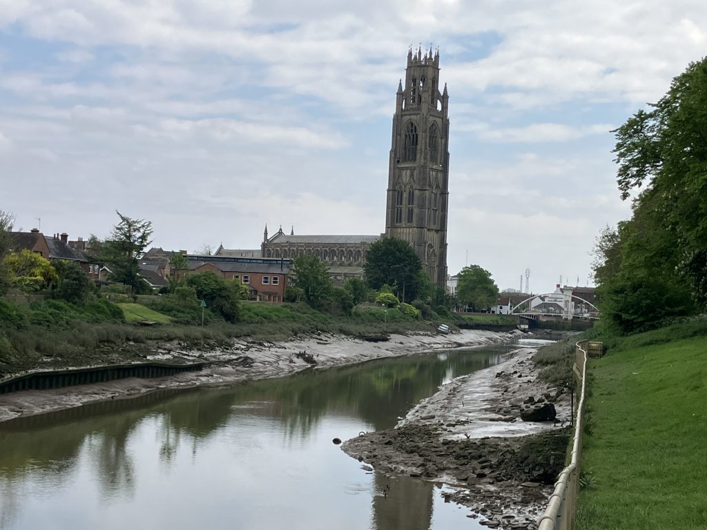
Coming round the last little bend towards Boston, I caught the first glimpse of the Boston Stump, aka the Parish church of St. Botolph. The tall tower looms over the town everywhere. When people give directions they just call it “The Church” and everybody knows.
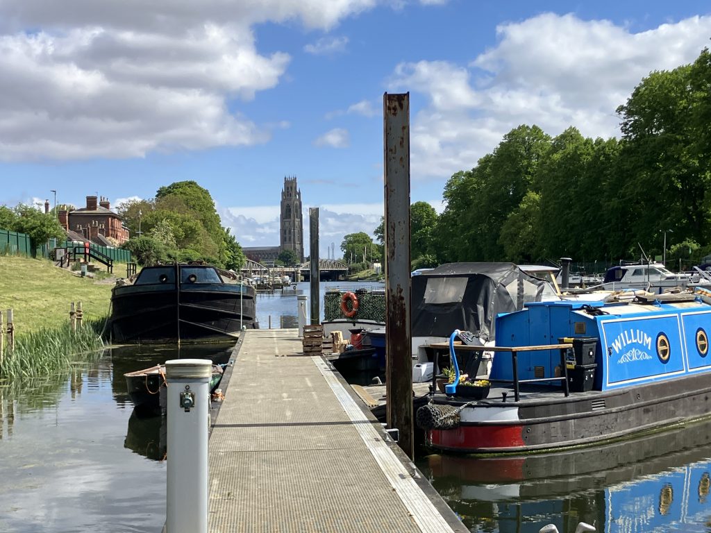
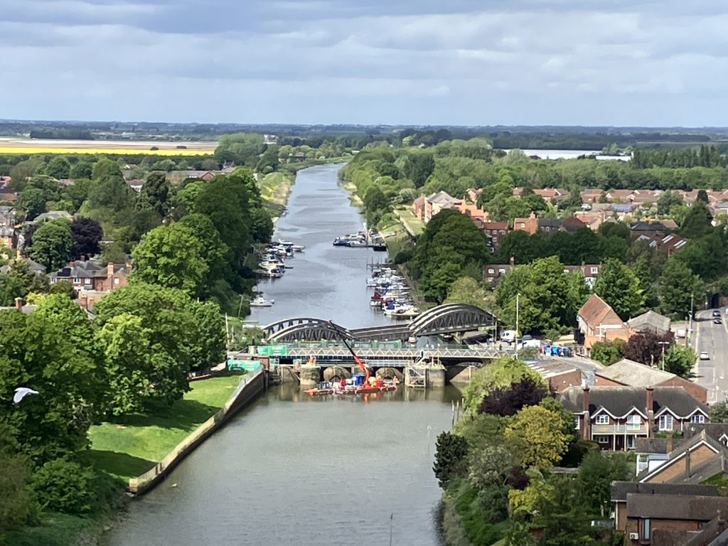
Cruising into town the church tower got closer and closer and the floating barrier of the Grand Sluice came into view not far ahead (more about the Grand Sluice here). I knew that the Grand Sluice is the end of the non-tidal navigation and I had no intention to go on the tidal (i.e. the Wash!) beyond. I panicked slightly as I couldn’t see the visitor moorings shown in the guide, but it turned out that the visitor moorings look very much marina style with finger pontoons and a locked gate. They are fabulous!
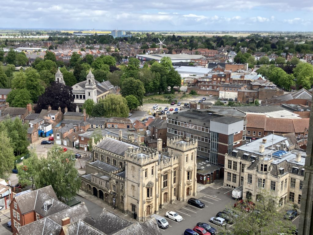
The Stump
St. Botolph is all but cathedral-sized, but “only” a parish church. The sheer size and flamboyant style tells visitors that Boston used to be a prosperous town with its port only second to London in the middle ages. It is a magnificent church, relatively plain inside, which gives great prominence to its architecture in the Perpendicular style.
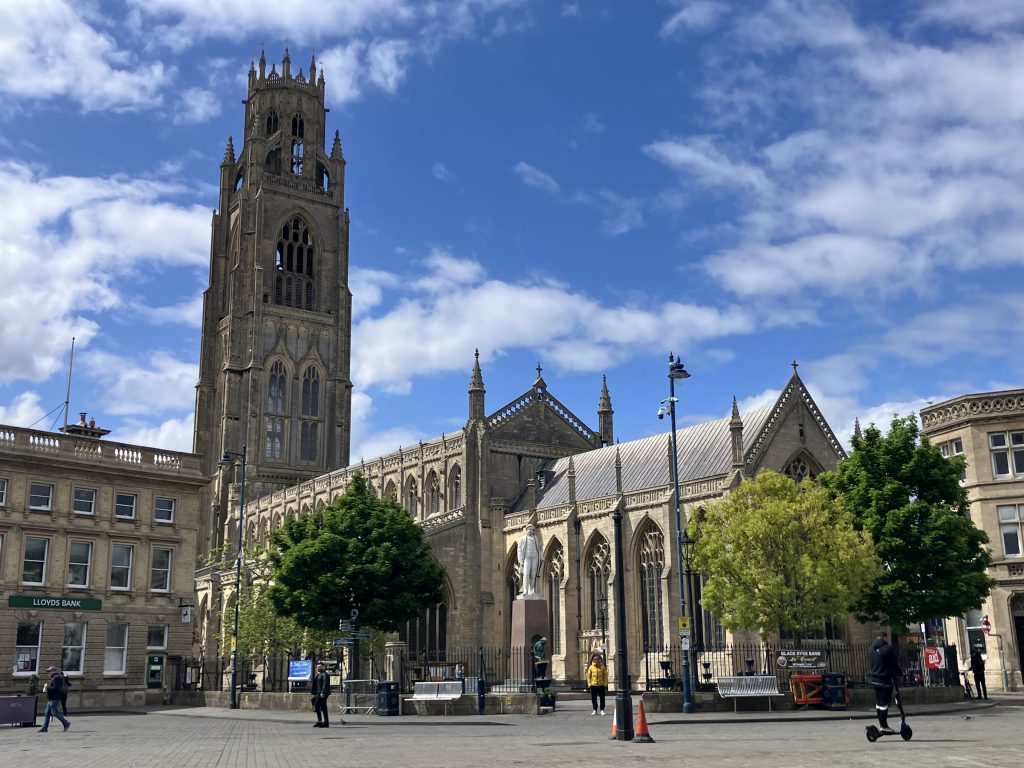
Naturally I went to the top of the tower, a slightly claustrophobic experience up a very tightly wound spiral staircase. The views are great though. I was told that you can see Lincoln cathedral on a clear day, which is more than 30 miles away.
The Drains
Boston has a number of “navigable drains”. Technically they are accessible by boat although the guide book says that they are not maintained for navigation, but only for drainage. The descriptions are rather vague with unclear depth and air draught requirements, and it is unclear where a 60ft boat can turn around and moor.
All this didn’t instil much confidence and I left those drains well alone. It was a good decision. When I visited Boston on foot and bike I saw some of the allegedly navigable drains and they had extremely low bridges and at least one lock, which looked like it hadn’t seen any traffic in a long time.
The only entrance to the navigable drains at Anton’s Gowt has actual grass (not weed!) growing across the entrance and it looks solid. It tells me that nobody has used this at least since the winter.
I did not see any boats on any of the drains.
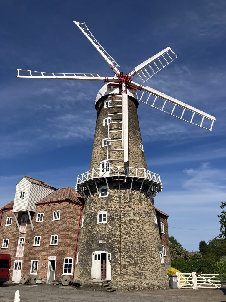
Maud Foster windmill
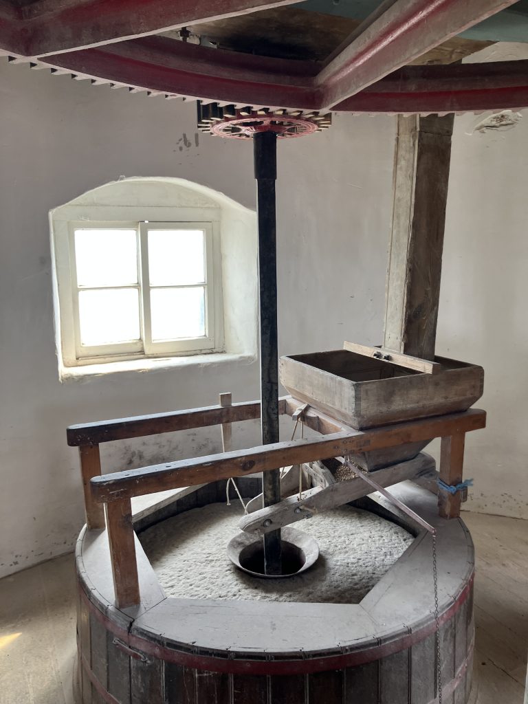
On the banks of the Maud Foster drain – one of the navigable ones allegedly – sits the very well preserved Maud Foster windmill. Unlike other windmills in the area it was not used to pump water into the river, but to mill flour. It is a great place to visit if, like me, you are interested in historic technology. All seven floors of the mill are accessible and you can see all the old equipment, how the grain was hoisted up to the top using the wind power and then processed on its way down.
The windmill is in family ownership and I had a long chat with the owner, who still mills flour on the ground floor today, albeit using electricity. The flour supplies bakeries in Boston and is also available at the mill and select shops. it was so lovely to see how passionate he is about preserving this piece of Boston history.
The return journey
After a brief seaside break in Skegness it was time to turn around and do it all again on the way back. As I had been unwell for some part of the way down I wanted to explore a bit more on the way back. Sadly my stopping to visit Tattershall castle was not possible, because the moorings nearby were all full.
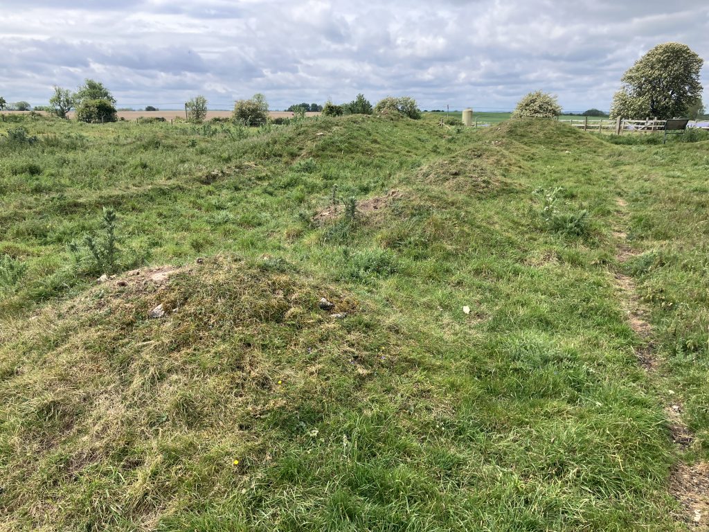
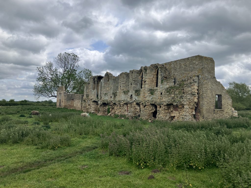
I did manage to visit a couple of abbey ruins near Bardney village. Before the dissolution there were nine monasteries clustered around the length of the Witham. This was when the area was rich from the wool trade and the monasteries were thriving.
I visited Bardney abbey, which was excavated in the early 20th century and promptly covered up again to preserve the ruins. Today, there are a number of boards around the site and the rest is up to the imagination.
The second one was Tupholme abbey, which at least has one wall standing. Even though the ruins were not the most impressive I have ever seen, it was nice to just get around the area a bit as often it is so difficult to get anywhere here, because of all the drains criss-crossing the land.
Retracing my journey back through Lincoln and down the Fossdyke, I am now back at Torksey lock, the lock to the tidal Trent ready for the next tidal adventure. This time I am doing it on my own, which will be a new challenge. But I am excited to explore the beautiful Chesterfield canal next. Stay tuned!
Leave a Reply