The river Witham and the Lincolnshire fenlands
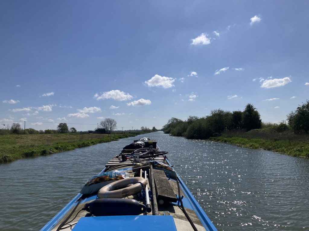
Crusing down the Witham towards Boston it is obvious that there are drainage channels all around and every now and then there is a pumping station emptying a drain into the river. It feels counter-intuitive that the water is pumped up to reach the river. This made me wonder how the water in the fens is actually managed.
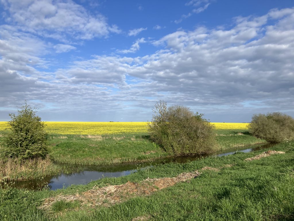
The Lincolnshire fens are low lying lands that used to be waterlogged and regularly flooded by both the Witham and tidal surges. The river meandered around and sometimes changed course. It had not been reliably navigable before the waters were brought under control. It would have been tidal both from the North Sea and possibly also the Trent side via the Roman Foss Dyke canal.
History
The breakthrough to cultivate the fens and create a reliable navigation between Boston and Lincoln came in the 18th century. In 1766 the Grand Sluice in Boston was built with the help of Dutch engineers, who were and still are top of the world to manage low lying lands.
The sluice held the tides back from the Witham and allowed to create a stable river level for navigation. The course of the river was straightened and high banks built to protect the land from flooding. In addition many drains were dug criss-crossing the land to drain the water. More than 50 windmills were built to pump the water into the river, later replaced by steam pumps.
The development of the fens was not uncontroversial at the time, as it displaced the people living there before, who managed to live off the waterlogged lands by fishing and grazing animals, just doing whatever was possible in this landscape. Boston had a flourishing wool trade for centuries, before this development happened.
Water management
The management of the water in the fens is fascinating. Since the building of the Grand Sluice the river level is kept close to high tide levels in order to to sustain navigable levels (in winter the level is lowered to give more room for possible flood waters). The drained land compacted when it was drained of water, so it is today several metres lower than it used to be and mostly below the river level. For the most part pumping stations pump water from the drains up into the river.
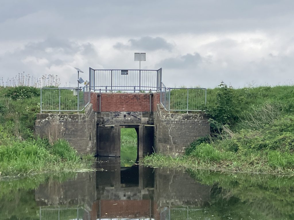
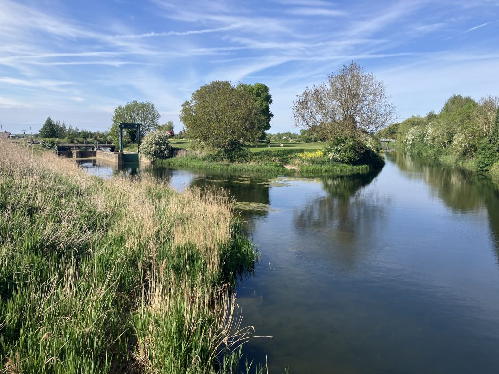
There are some drains however that are on the same level as the river. Under normal river conditions water flows freely between the river and those drains. However, for flood protection those drains are connected to the river with flood doors. Under normal conditions the doors are open, but they are shaped in such a way that upon the river level rising they automatically close, in the same way as lock gates do, to avoid the river overwhelming the drains. This is a very clever mechanism as it requires no manual intervention at all.
The drains as transport highways
The drains were not just used for drainage of the land, but also as transport routes. Boats could sail along the larger drains and lower their mast quickly using counterweights if they had to pass under a bridge (anybody who has sailed on the Norfolk Broads knows what this looks like). And unless they have all been removed, from my observation there were not many bridges over the drains anyway.
In absence of bridges, allegedly residents used poles to vault the drains (this is still a sport in the Netherlands!). An elderly gentleman, who was a very knowledgable volunteer in a museum, told me that his grandad broke his hip vaulting a drain after a visit to the pub. In the winter when the drains froze, residents would skate on them pushing themselves along with poles for speed.
It is a bizarre landscape!
The Grand Sluice
What made all this possible is the Grand Sluice in Boston from 1766. It is quite a confusing structure to look at. I expected a weir that controls the water level in the non-tidal part of the Witham similar to the one at Cromwell lock that marks the top of the tidal river Trent.
When viewed from upstream you can see a barrier, but no weir. At one side there is a normal lock for boats to pass through.
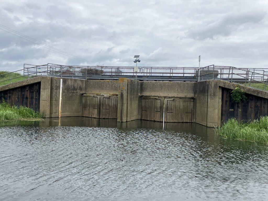
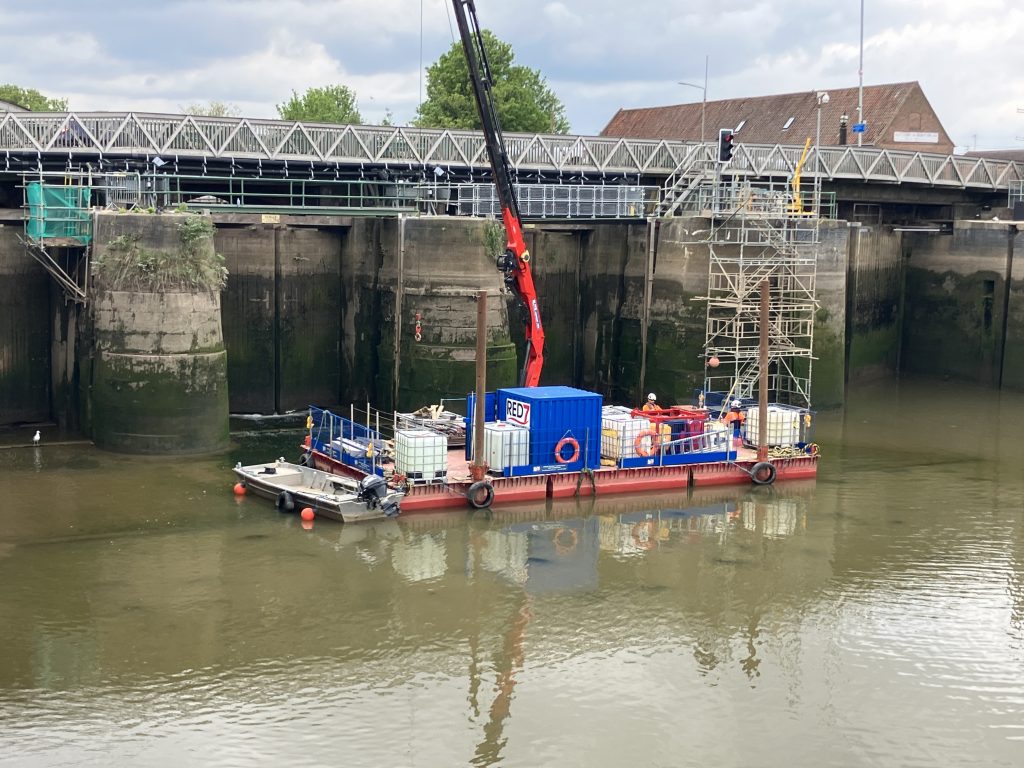
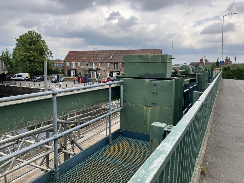
But when viewed from downstream, you see a set of angled doors. These are not really suitable to control the water level. In fact they are for flood protection as they keep out the tide. I assume that in the same way as the flood gates on the drains, they close automatically when the tide rises high enough. Here are some close-up pictures showing how massive these doors are.
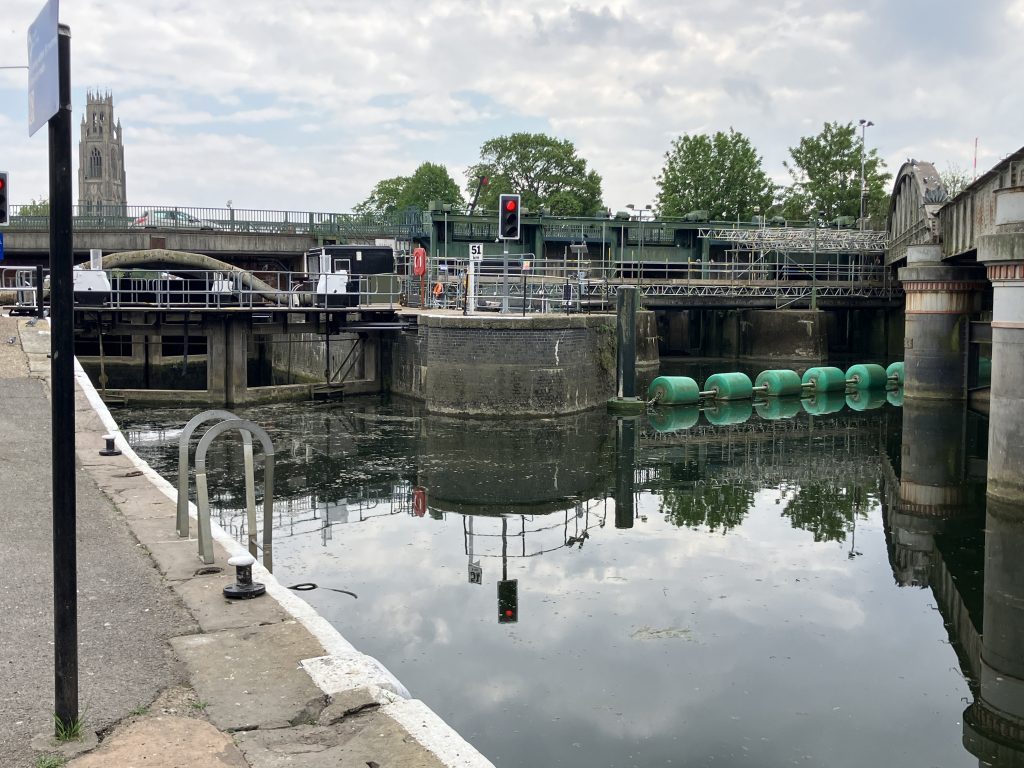
I was puzzled how the sluice actually works. Reading up on this I learnt that behind the flood gates are guillotine gates that can be pulled up or down to regulate how much water passes through from the non-tidal to the tidal part. That is the actual “weir” part of the sluice. The guillotine gates are not visible from the outside as they are located under the road bridge.
It also didn’t help that there is a lot of scaffolding for the multi-year refurbishment works.
When the tide is out, the guillotine gates are pulled up and the flood gates opened to let water coming down the river out. According to one boater I chatted to, in the winter this can lead to quite a sudden fierce flow in the river.
I did not encounter much flow at all as levels were quite low at this time. Also due to the refurbishment works the gates are kept shut during the day when work is underway.
The Port of Boston
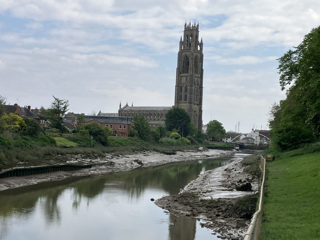
Once the Grand Sluice was built in 1766 navigation up the Witham to Lincoln and beyond became possible. But long before that, in the 14th century, Boston became part of the Hanseatic League and its port enabled a flourishing trade of mainly wool export across the sea. At some point the port of Boston was second only to London in terms of trade volume. Boston was a prosperous town, as seen in the massive St. Botolph parish church (“The Stump”), which is the largest in England.
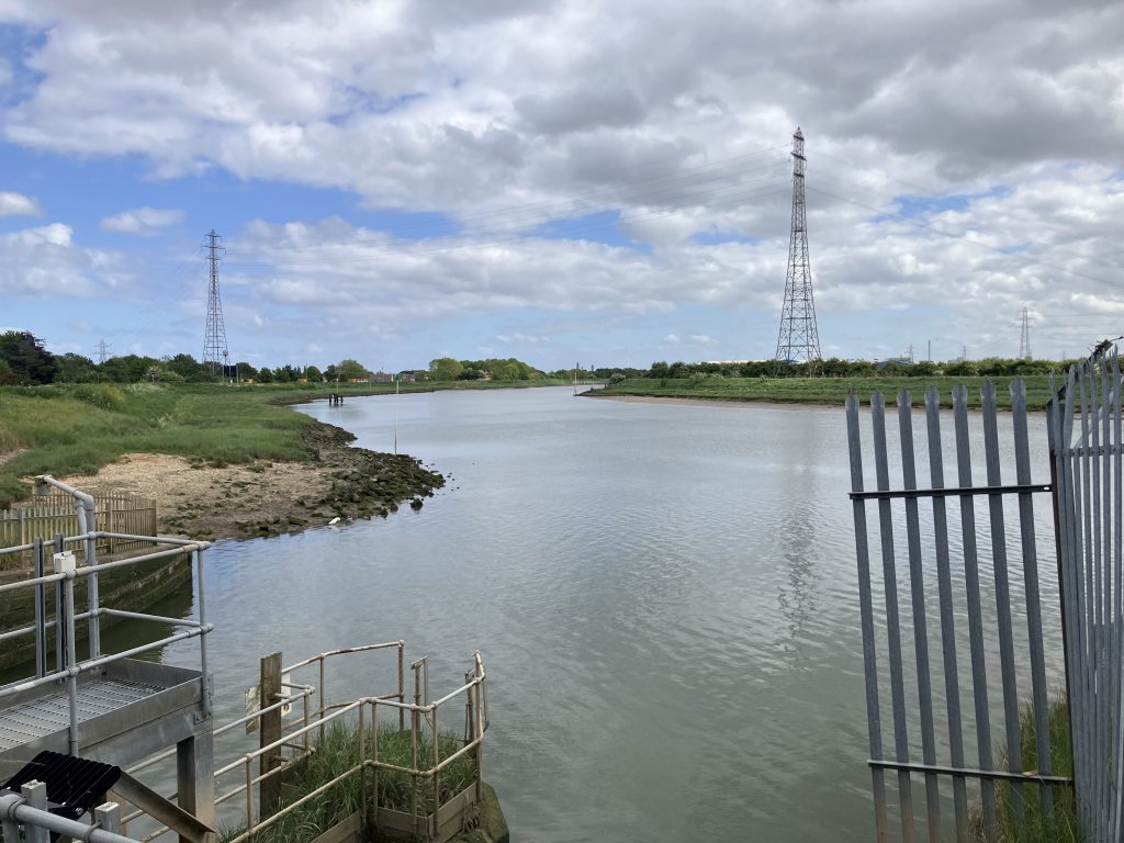
For most of its life time the port was tidal, which limits what types of ships can dock there. In the 19th century a lock was built to enclose the basin, so that the water level can be kept up in the port. The port is still in operation today about a mile from the town centre toward the Wash. The size of ships is still limited as the port sits quite far inland on a tidal river.
The port is not really accessible to visitors, hence no pictures from me. The port is to the right in this picture behind a locked gate.